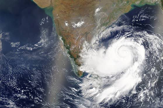
Visakhapatnam: Close on the heels of cyclones Arnab and Murasu, another system is brewing up in Bay of Bengal. A Low Pressure Area is likely to form over Southeast Bay of Bengal around November 13 and is likely to move northwestwards and become a well marked low pressure area during subsequent 24 hours, said IMD Aamaravati in a bulletin on Tuesday.
Private weather website Skymet said the system might move to the South-Central Bay of Bengal, maintaining proximity to the equatorial region. There are chances of a low-pressure area forming over the same region on November 13. Sea surface heat potential and the wind profile favour the sustenance and growth of the system.
However, there is no model consensus at this stage on the further prospects of the system. As such, the clues start becoming more informative after the system gets conceived over the ocean as a low-pressure area. Even climatologically, there is large diversification in the cyclonic storms developing over the Andaman Sea at this point in time. There are three possibilities with equitable chances of occurrence. One – the system could gather strength and head for Tamil Nadu and South Coastal Andhra Pradesh, more akin to ‘Murasu’, second- the storm could come over the Southwest Bay of Bengal and recurve, avoiding landfall along the coastline of Tamil Nadu and Andhra Pradesh. The third possibility is the storm has a bleak chance of getting steered early towards the Myanmar coast.
More clarity would be known by November 12-13.
The storm, if it develops, will be named ‘Akvan’, as suggested by the member country Iran.
Disclaimer : This story is auto aggregated by a computer programme and has not been created or edited by DOWNTHENEWS. Publisher: deccanchronicle.com