
Two Met Office yellow weather warnings are in force for snow and ice across Scotland and northern England as Arctic air is poised to make a return.
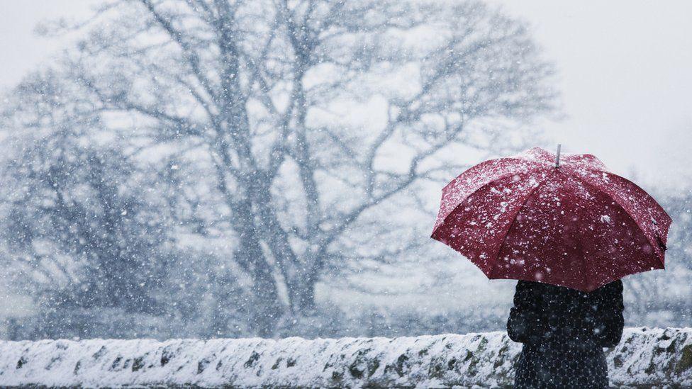
Friday will feel much colder for the UK with temperatures plummeting overnight bringing the first widespread frost of February.
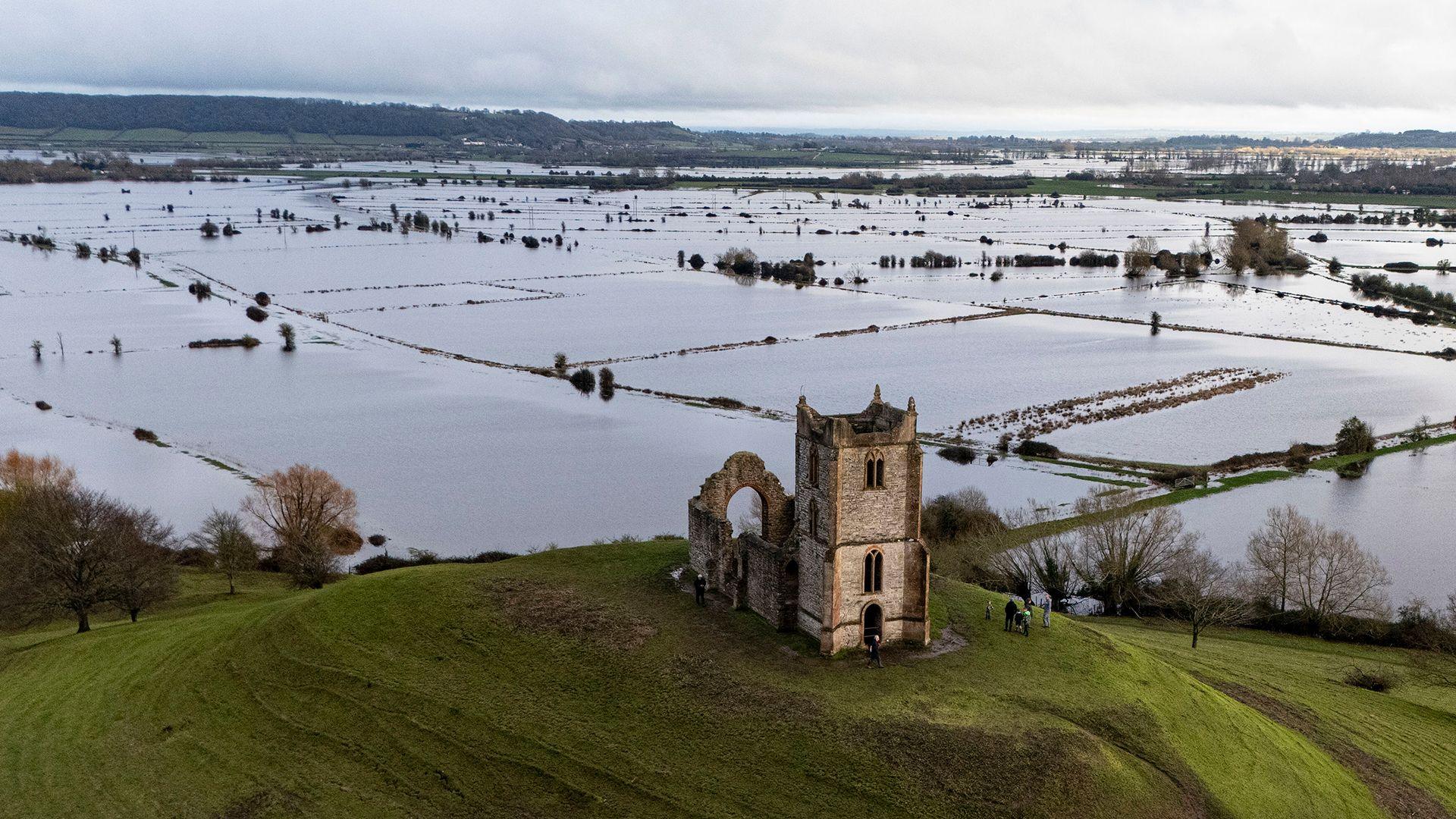
This marks a significant change in our weather, after weeks of record-breaking damp and dismal weather caused by a “blocked” weather pattern.
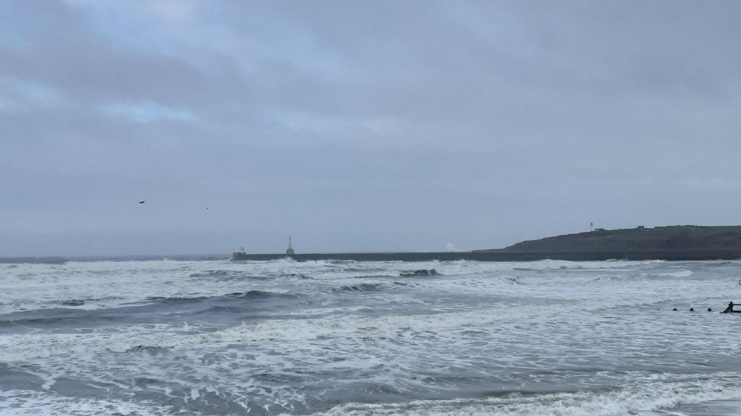
But some good news as the city of Aberdeen saw its first ray of sunshine on Thursday after three weeks of gloom.
Weather warnings in force
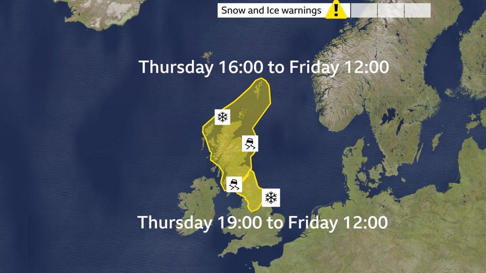
A yellow warning is in force for snow and ice overnight on Thursday and into Friday for Scotland. Snow amounts of a few centimetres even on lower roads could be in store by Friday morning.
On hills above 300m there could be up to 2 to 5cm, with 10cm possible in places.
In addition to the snow, ice will also be a hazard.
A second yellow warning for snow and ice is also in force for northern England and the north Midlands. Here snow will fall at low levels but is not likely to settle below 200 metres. These higher levels could see 2 to 5cm and it’s expected that a few locations above 300m may see as much as 10 cm.
This is likely to cause disruption on routes across the Pennines and for Derbyshire and Cumbria. With temperatures plummeting below freezing overnight, the combination of snow and ice could lead to treacherous conditions on untreated roads and pavements.
Saturday will start cold and frosty with the whole of the UK seeing some sunshine and should be the driest day for a good while.
However Saturday night and Sunday brings a renewed risk of snow, quite widely and even at low levels. Keep checking the BBC Weather website and app for all the latest details.
And the hour-by-hour forecast for your area is always available on the BBC Weather website and app.
Record Aberdeen gloom has ended
 BBC Weather Watcher / janner58
It’s been wet and grey for many parts of the UK – none more so that the city of Aberdeen in north-east Scotland.
After three weeks of gloom the Sun finally made a welcome return to the skies between 15:00 and 16:00 on Thursday afternoon.
Although its appearance only lasted for just over 30 minutes it was enough to signal the end of the record breaking cloud cover the city had seen.
Surrounding areas in north-east Scotland might well have seen a little blue sky on Thursday too, but Friday is the day when the cycle will be properly broken and the sunshine will return more widely.
Across England 75 flood warnings remain in place with the Environment Agency warning of “ongoing flooding from groundwater probable” for parts of Dorset, Wiltshire, Hampshire, West Sussex and possibly Kent as well as an ongoing flood risk from rivers across Somerset and Wiltshire and the River Trent.
Cold health alert issued
In response to the forecast Arctic blast, the UK’s Health Security Agency has also issued yellow alerts for the colder weather across northern England and the Midlands, from 06:00 GMT Friday to 08:00 Monday.
They warn that the weather is likely to have “minor impacts on health and social care services, including increased use of healthcare services and a greater risk to life of vulnerable people”.
Temperatures will stay below average over the weekend, returning to more what we’d expect of around 2-5C by Tuesday.
-
-
18 hours ago
-
Disclaimer : This story is auto aggregated by a computer programme and has not been created or edited by DOWNTHENEWS. Publisher: BBC


