
Extensive flooding is ongoing across parts of the UK, especially in southern and central England.
The Environment Agency and Met Office have come together to warn homeowners and businesses to remain vigilant as the wet weather is due to continue for another month.
Around 60 flood warnings and 180 flood alerts are still in force across England, as well as two flood alerts in eastern Wales.
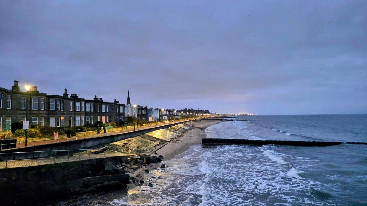
The saturated ground means that floodwaters are only very slowly receding in many places. High tides and strong winds may also bring tidal flood risk along parts of the coast.
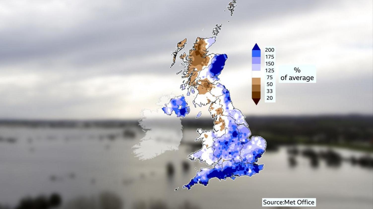
How wet has it been?
This year so far has been dominated by successive areas of low pressure which have brought heavy and prolonged rainfall across many areas.
A series of named storms including Goretti, Ingrid and Chandra have been interspersed with brief drier spells, but a blocking area of high pressure to the east has led to consistently unsettled conditions for several weeks. Southern England, eastern Scotland and Northern Ireland had one of their wettest Januarys on record.
Wet conditions persisted into the start of February too. Parts of eastern Scotland received more than twice the monthly average rainfall in just the first two weeks. Some places in southern England have seen rainfall every day this year. The last dry day in Cardinham in Cornwall was 30 December.
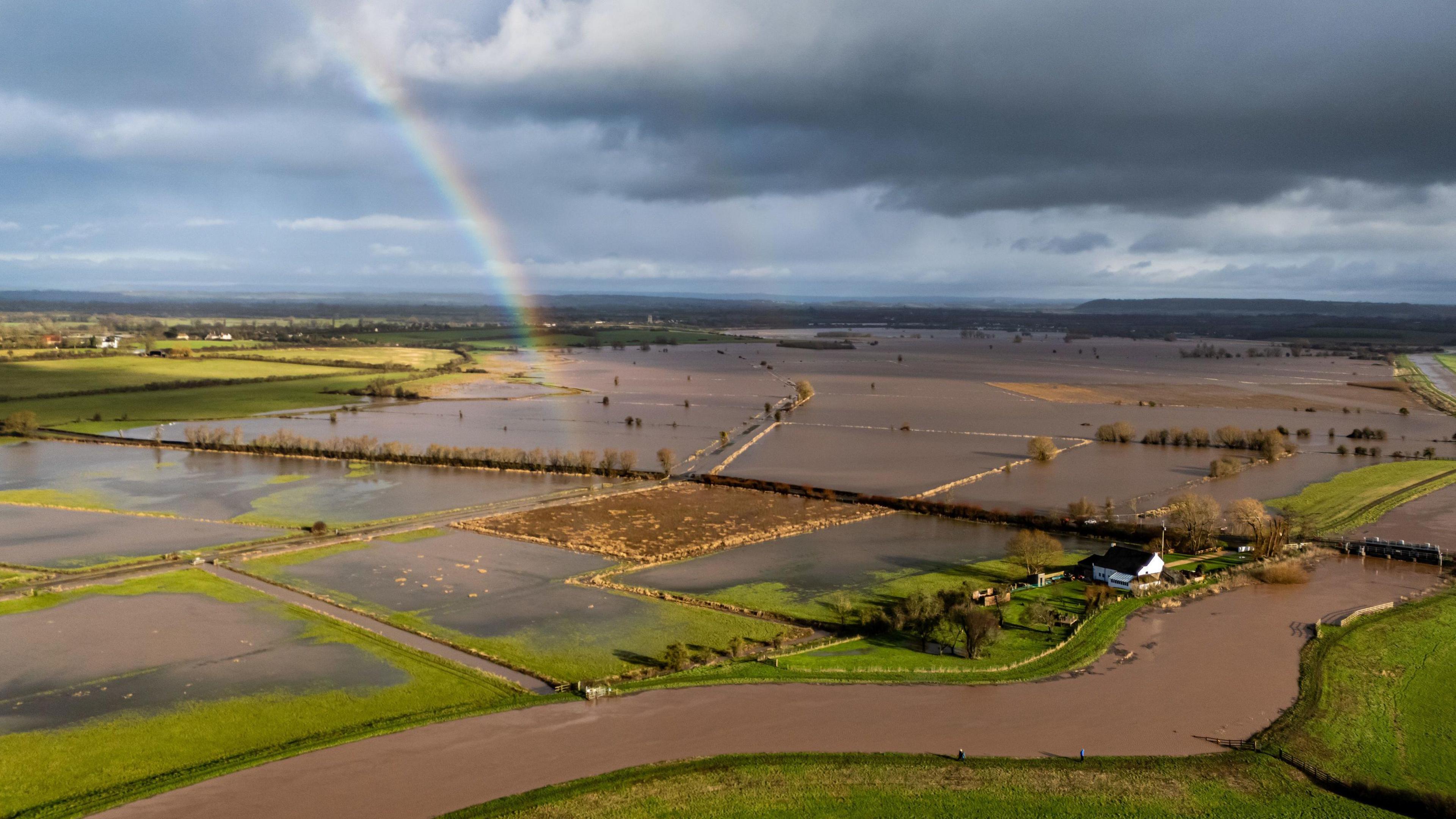
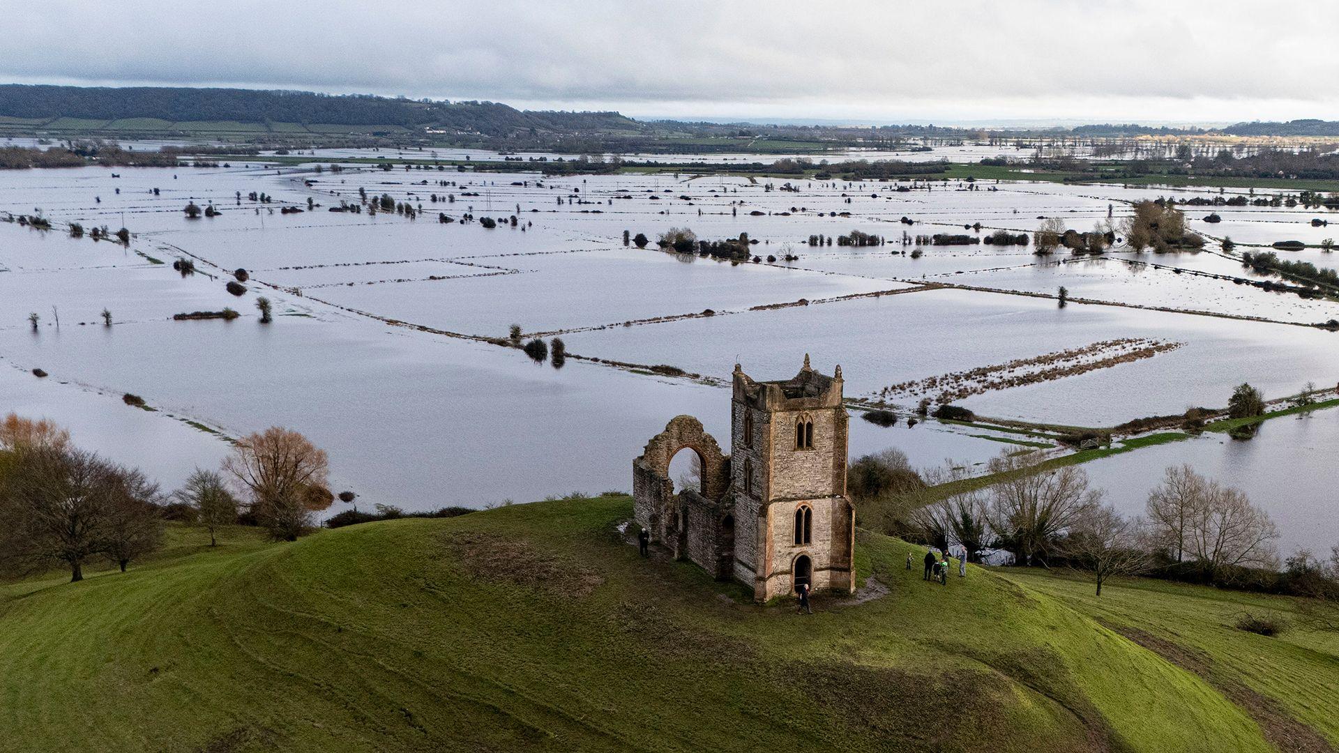
In Somerset approximately 29 square miles of the Levels and Moors have been flooded.
Whilst this winter has been exceptionally wet in places, it is unlikely to be as wet as the winter of 2013-14 – the UK’s wettest winter on record.
 Ben Birchall/PA Wire
The heavy rainfall we have seen during autumn and winter has been much needed because it has followed a significant drought that developed in 2025 across parts of England and eastern Scotland. The UK saw its hottest summer on record, as well as the driest spring in England since 1893.
Groundwater levels and reservoir stocks across much of the UK have risen significantly over recent weeks. Bewl Water reservoir in Kent is currently more than 88% full, compared to just 42% back in October 2025.
By mid-January all of England was declared drought-free for the first time since May 2025.
What is groundwater flooding?
Different types of flooding have impacted the UK so far in 2026. We have seen fluvial – or river – flooding, which is when rivers or streams burst their banks and flood surrounding areas. There has also been pluvial – or surface water – flooding, which is a direct result of intense or prolonged rainfall that overwhelms drainage systems.
However, a third type of flooding – groundwater flooding – has also been a widespread problem, especially in parts of southern England. Low lying river valleys and areas on chalk aquifers – such as the Salisbury Plains – are most prone to groundwater flooding.
The Environment Agency says groundwater flooding occurs when water under the ground (the water table) rises to the surface. This can lead to water filtering upwards above roads or into cellars and basements.
Unlike fluvial or pluvial flooding that tends to improve relatively quickly, the British Geological Survey (BGS) says: “Groundwater flooding tends to remain around for weeks or even months at a time, and so causes greater damage to properties.”
Infrastructure below the natural ground level such as tunnels, roads and railway cuttings can be particularly badly affected by groundwater flooding, and the BGS also says “Flooded septic tanks and sewers may mean toilets can’t be flushed”.
In Wales, Scotland and Northern Ireland groundwater flooding is often less extensive than in England due to the bedrock geology and topography. The vast majority of water supplied in Wales comes from rivers and reservoirs, which are currently at more than 90% capacity across the country.
The Scottish Environment Protection Agency (SEPA) warns that high groundwater levels could potentially “contribute to the extent and duration of other sources of flooding such as river or surface water flooding”.
 Prof Ed Hawkins, University of Reading
Is climate change increasing the risk of groundwater flooding?
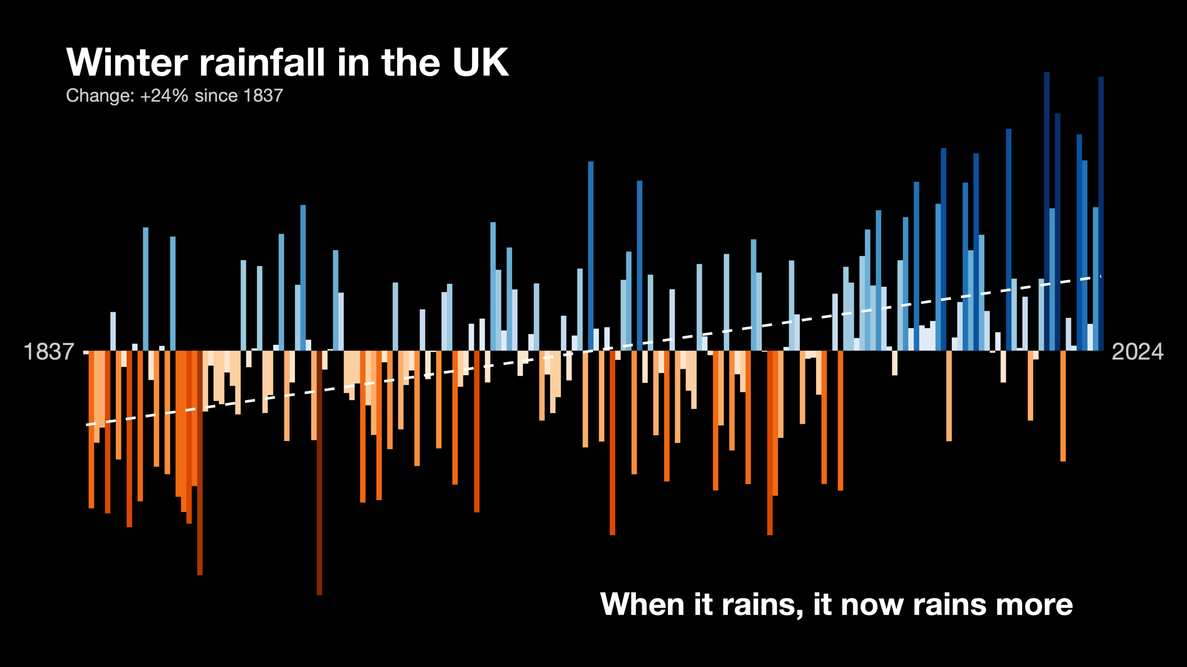
In short – yes. As our world continues to warm, extreme rainfall is becoming more frequent and intense. For every 1C rise in air temperature, the atmosphere can hold 7% more moisture. When it rains, it now rains more, especially during the winter half of the year. Met Office predictions for our future climate show a trend towards wetter winters and drier summers.
Groundwater flooding risk may therefore continue to rise during the winter half of the year (October to March) in line with future rainfall predictions and rising sea levels.
The Met Office thinks that, during the summer months, despite an overall drying trend, there are likely to be increases in the intensity of summer rainfall events too. Therefore short-term flash-flooding from localised intense thunderstorms is expected to increase as well as the longer lasting impacts of groundwater flooding.
It is important to note, though, that many other factors affect the risk of flooding including land use, groundwater extraction, local hydrology and preceding conditions.
 BBC Weather
When will the rain stop?
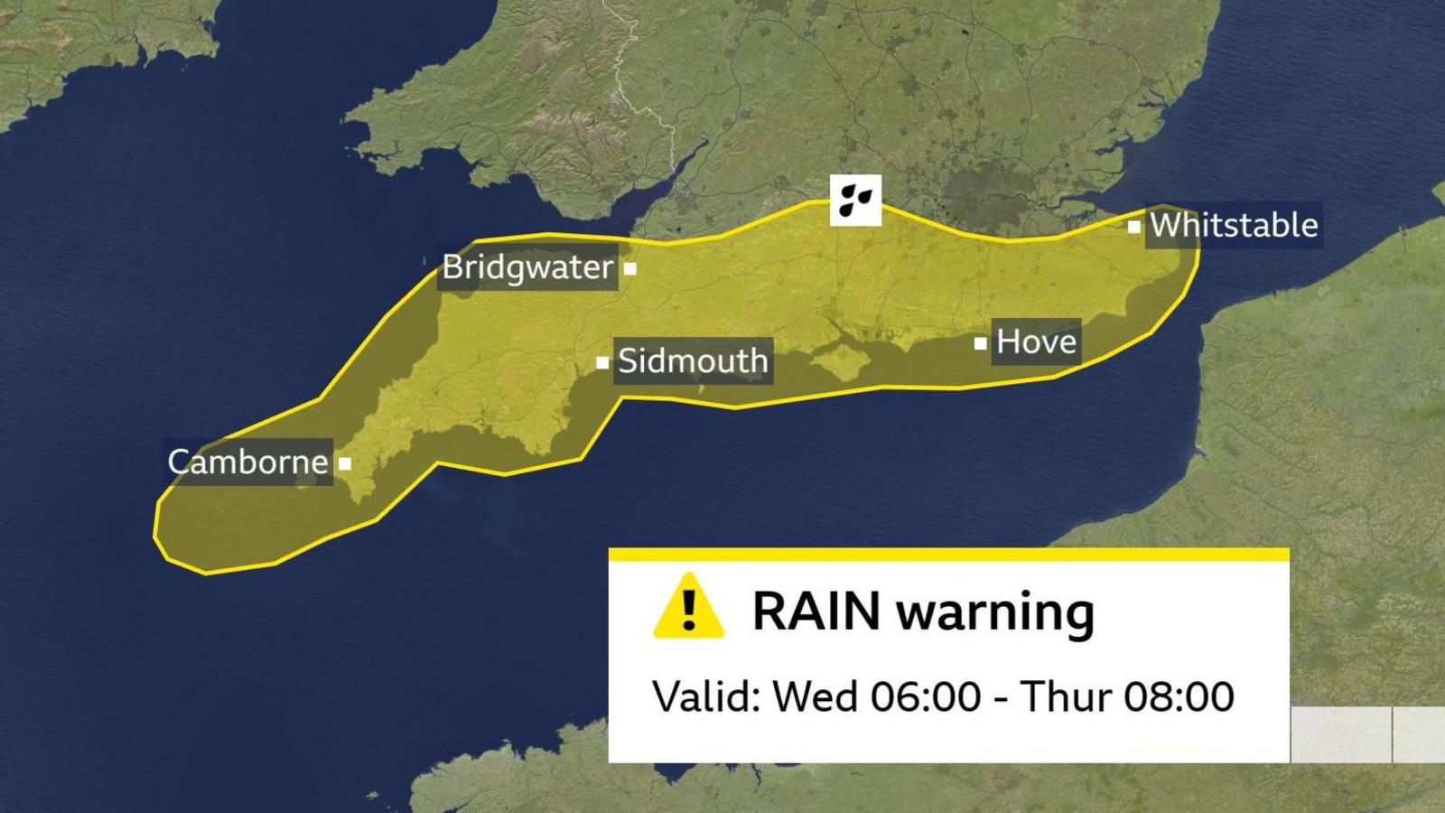
In the short and medium term, the forecast remains unsettled. More rain is expected to move in from the south during midweek and the Met Office has issued a yellow rain warning for southern England valid from 06:00 Wednesday until 08:00 Thursday. Another 10-30mm (approx 1in) of rain is possible, with perhaps 50mm (2in) falling over higher ground places such as Dartmoor.
The longer range forecast for the rest of February and into March shows our weather remaining very changeable with wet weather at times.
Now that the blocked weather pattern – which has been the reason for the relentless rain so far this year – has finally changed, it means that low pressure systems will sit in different areas and progress across the UK more than they have done.
There are signs that the wettest weather will become more focused in the north and west, whilst sheltered areas towards the south and east could see a welcome respite with some longer drier spells between the downpours. But with many rivers still very high and saturated ground any further rain could still bring the risk of more flooding.
Check the longer-term forecast
-
-
22 hours ago
-
Disclaimer : This story is auto aggregated by a computer programme and has not been created or edited by DOWNTHENEWS. Publisher: BBC


