
Weekend to bring cooldown after record-breaking heatwave
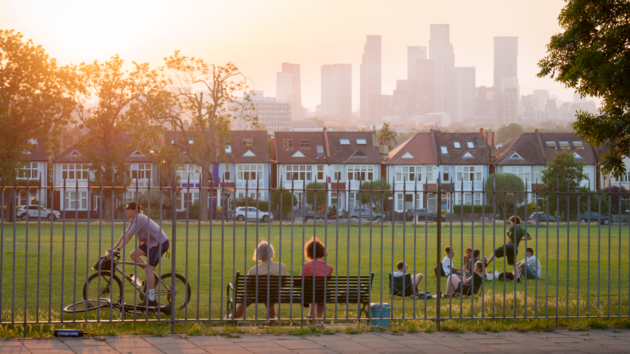 Image source, Getty Images
-
Published
Cooler air is set to move across the whole of the UK this weekend to end a spell of record-breaking heat.
But it will take its time to reach eastern and south-eastern England where it will remain searingly hot throughout Saturday.
There is a further Met Office amber warning in place for extreme heat on Saturday that is valid until 21:00 across south-east England and East Anglia.
Westerly winds and a weak cold front will eventually sweep fresher air in from the Atlantic by Sunday and next week is set to feel very different for most.
Cooler for many but not all on Saturday
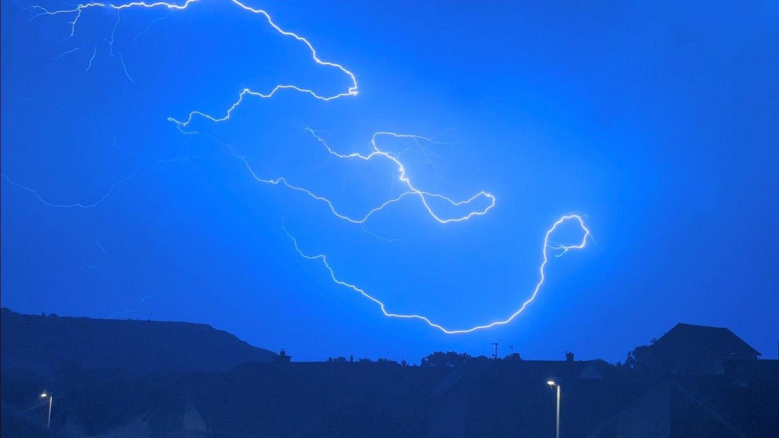
Temperatures on Saturday will drop back to the mid to high teens for many, although still around 17-20C for the south-east of England and there have been some overnight thunderstorms too.
High pressure, which has been responsible for the sunshine and heat, is starting to retreat eastwards and low pressure is centred to the north-west of the UK, bringing weather fronts in from the Atlantic.
The wind will be turning from a southerly to more of a westerly bringing about the change to cooler conditions.
Despite a cloudy start, Scotland will see a mixture of sunny spells and scattered showers developing for most, heavy in places and locally thundery.
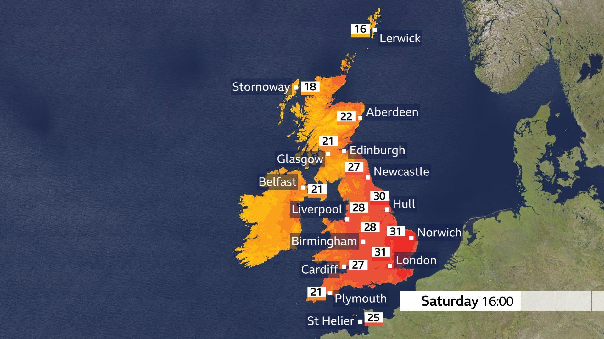 Image source, BBC Weather
Northern Ireland will also see outbreaks of showery rain and some sunny spells.
There will be a moderate to fresh south-westerly wind in the north and west of the UK and across Scotland, Northern Ireland, western Wales and the far north and south-west of England will tend to peak in the low twenties.
Central, eastern and south-east England will still be hot with afternoon temperatures in the high twenties or low thirties. Here the winds will be lighter and there will be more strong sunshine with the chance of some isolated thunderstorms.
When will the heatwave end?
Sunday marks the end of the current heatwave for all of us.
Weather fronts will move eastwards overnight into Sunday on south-westerly winds bringing cloud and scattered showers across the UK. Some of the showers could be heavy especially across southern England.
There will be some sunshine ahead of and behind the front which will drag behind it the cooler air. Scotland and Northern Ireland will see the mid to high teens, with possibly the low twenties in eastern Scotland.
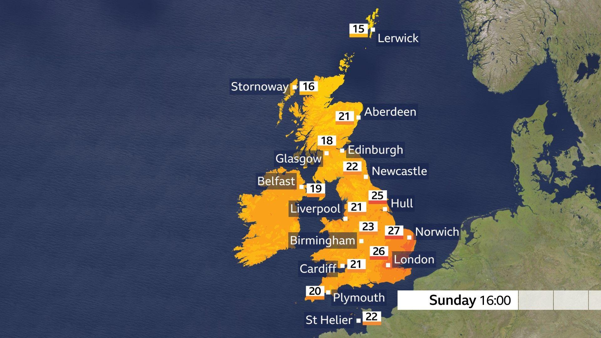 Image source, BBC Weather
England and Wales will be warmer with temperatures in the low twenties for many. There will be relief at last from the extreme heat in the east and south-east of England with temperatures in the mid-twenties.
Check the full forecast where you live here.
Will there be more heatwaves this summer?
There have been two UK heatwaves already this year resulting in new national monthly records.
There is still a whole lot more summer to go too, with meteorological autumn not beginning until 1 September.
Long-term forecasts for the next two months suggest that significant bursts of heat are likely and that temperatures will be above average.
According to the Met Office, a hotter summer is twice as likely as at the beginning of the century.
-
-
Published10 hours ago
-
-
-
Published2 days ago

-
Disclaimer : This story is auto aggregated by a computer programme and has not been created or edited by DOWNTHENEWS. Publisher: newsrss.bbc.co.uk


