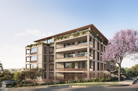

A $44 million plan to bulldoze five single- and two-storey Mosman homes to make way for a six-storey apartment block has been rejected after a 15-month planning battle boiled down to a deceptively simple question: how far must a pedestrian safely walk to reach their local shops?
The NSW Land and Environment Court has dismissed developer Metis Group’s appeal against Mosman Council’s refusal of its 29-unit project on a 2000-square-metre site in Awaba Street, after the proposal generated more than 100 written objections from residents and prompted months of legal arguments.
The decision could have implications for the NSW government’s push to increase housing density across Sydney through its low- and mid-rise housing reforms, because the case turned on whether the site fell within a crucial 400-metre “safe walking distance” of Spit Junction.
Under the government’s low- and mid-rise housing (LMR) reforms, sites within 400 metres of 171 eligible town centres across NSW can qualify for greater density, floor space and building heights of up to six storeys – and up to eight if affordable housing is included.
But sites between 401 metres and 800 metres from a centre face a lower four-storey height limit – a two-storey difference that can have major consequences for a development project’s feasibility.
The LMR policy, introduced in 2024, is a key part of the government’s efforts to increase housing supply by allowing greater density on land previously restricted to low-rise housing.
Metis Group argued the Awaba Street site was safely inside the crucial 400-metre LMR boundary, based on a 383-metre walking route to Spit Junction through residential streets and footpaths and across an unsignalised section of Ourimbah Road – a four-lane thoroughfare running through the lower North Shore.
To demonstrate that the route was safe, Metis presented evidence to the court including independent traffic engineering reports, video footage of 250 pedestrians crossing Ourimbah Road each day, and Transport for NSW data showing no crashes along the route over a decade.
However, Mosman Council contested the route, arguing that forcing pedestrians to negotiate four lanes of traffic across the unsignalised section of Ourimbah Road was inherently unsafe.
It argued pedestrians would instead use a safer route via traffic lights further along Ourimbah Road – a journey adding 40 metres to the route, bringing the total walking distance to 423 metres and placing the Awaba Street site outside the critical 400-metre zone.
In her ruling, Land and Environment Court Commissioner Nicola Targett sided with the council, finding pedestrians would “reasonably and practically” use the safer route, particularly given Ourimbah Road’s status as a regional arterial road, which she noted carries up to 1000 vehicles an hour.
Without the additional height and density permitted under the LMR reforms, the proposed development was non-compliant. The court dismissed Metis’ appeal and ordered the developer to pay $15,000 towards the council’s legal costs.
The ruling has raised questions about how sites across NSW will be assessed under the LMR reforms, which are intended to support 112,000 new homes by 2029 as part of the government’s goal of meeting the National Housing Accord target.
Metis Group co-founder Arian Galanis said the decision introduced unpredictability into a development sector already grappling with elevated construction costs and tight operating margins.
“If whether a site qualifies can turn on a judgment about which walking route is deemed safest, that is a difficult basis on which to identify, validate, plan, and invest in housing in the state,” he said.
“Developers are being asked to take substantial personal and financial risk without a clear baseline, and many other well-located properties across NSW will now face the same ambiguity.”
University of Sydney urban planning professor Nicole Gurran said the case demonstrated the problems created by applying a fixed distance around town centres without considering how people actually move through an area.
“Planners and local councils have been consistently saying that you can’t just draw a 400-metre circle around a town centre for greater density within it,” Professor Gurran said.
“A far more reasonable approach is site-based planning that takes into account the existing constraints and opportunities.
“[The case] is a perfect example of how, in the rush to liberate sites for housing supply, you actually create uncertainty because you are creating false expectations for the development sector.”
Mosman Council, in a statement, said it welcomed the decision as a “positive outcome” for a community that had “felt very strongly about what was proposed.”
That included Peter Papilos, one of 105 residents who lodged submissions opposing the proposed development over its bulk, scale and traffic impacts.
“As the crow flies, yes, the site is less than 400 metres from Spit Junction,” he said.
“But people are not crows, and they shouldn’t be expected to negotiate streams of traffic with buses and trucks just so a developer is eligible for major increases in building height.”
The Morning Edition newsletter is our guide to the day’s most important and interesting stories, analysis and insights. Sign up here.
 David Barwell is an urban affairs reporter for The Sydney Morning Herald.Connect via email.
From our partners
Disclaimer : This story is auto aggregated by a computer programme and has not been created or edited by DOWNTHENEWS. Publisher: www.smh.com.au