
A remarkable display is expected in the skies over the UK later this week as a vast plume of Saharan dust drifts north over much the country.
The dust, made up of fine sand and mineral particles lifted from the deserts of North Africa, will have travelled thousands of miles on warm southerly air currents.
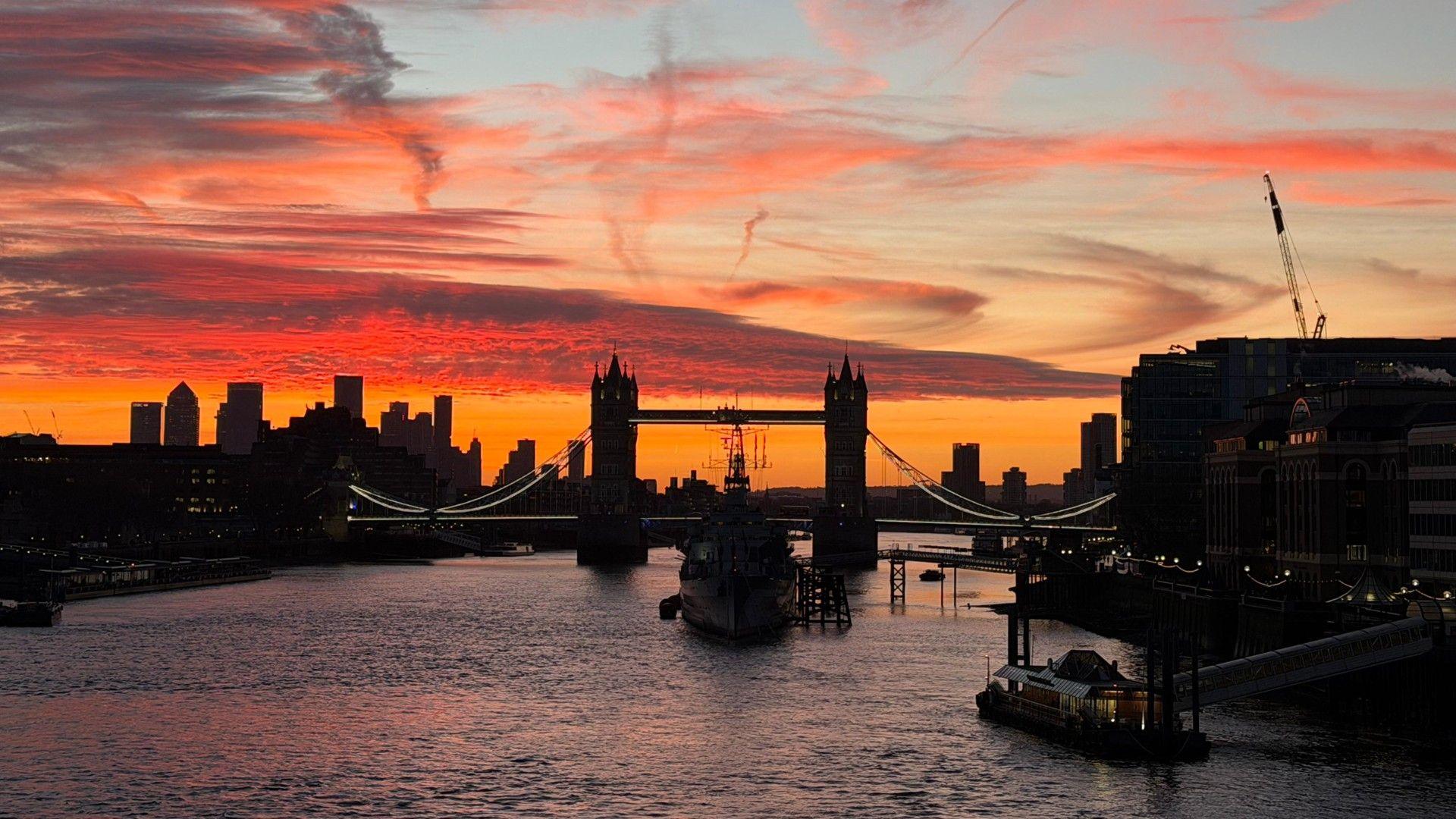
As it moves across the UK, it is expected to transform ordinary sunrises and sunsets into striking displays of deep gold, amber, and burnt orange.
However, the downside of Saharan dust is that when it mixes with rain, it can leave dirty deposits on surfaces, particularly cars and windows, a phenomenon commonly known as blood rain.
 Weather watcher / captain_america
The brightest colours are expected on Thursday and continuing into Friday, especially when skies are clear at sunrise and sunset.
The most noticeable displays are likely to occur in England and Wales as clearer and cooler conditions arrive from the west by the end of the week.
Over the past few days Iberia has been battered by Storm Regina, bringing heavy rain, strong winds and widespread disruption.
As the storm tracked eastward into the western Mediterranean, it drew up warm southerly winds from North Africa, lifting fine Saharan dust high into the atmosphere.
This dust is now set to be carried towards the UK around an area of high pressure that is currently delivering fine, mild, and sunny conditions.
What is ‘blood rain’?
 Getty Images
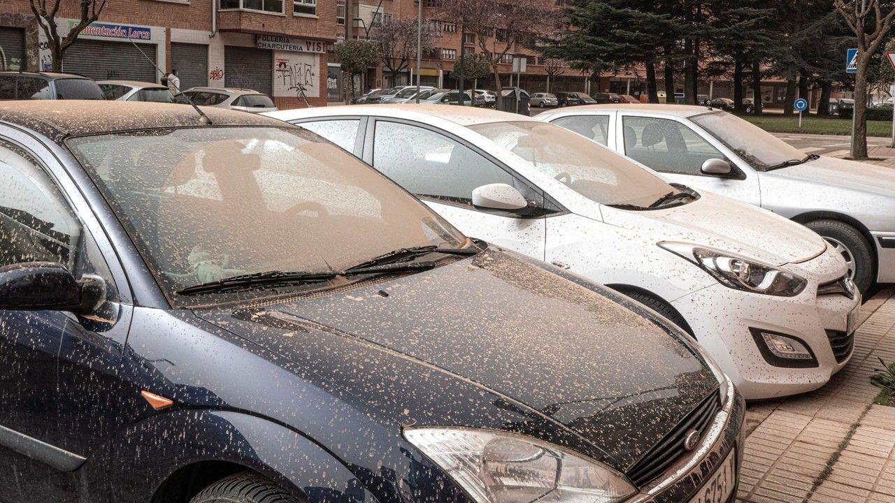
When Saharan dust mixes with rain it creates what is commonly known as blood rain.
Tiny dust particles suspended in the atmosphere are captured by raindrops and deposited onto surfaces, leaving a thin, gritty, reddish-brown residue.
Cars, windows, garden furniture and other outdoor items can become noticeably coated, sometimes requiring a wash to remove the marks.
Parts of England and Wales are expected to experience the most pronounced effects, as dust concentrations are forecast to be highest there due to prevailing winds and the position of high pressure system.
Even areas with lighter dust may notice a faint film on surfaces after rainfall.
Despite its dramatic name and unusual appearance, this type of rain is entirely harmless.
The dust poses no health risk for most people, and any disruption is largely cosmetic.
It is a natural result of Saharan dust being carried long distances by the atmosphere, offering a rare, and sometimes messy, reminder of how far-reaching global weather systems can be.
Why do we see these colours at dusk and dawn?
The striking colours appear high in the atmosphere, where the Saharan dust stays suspended for several kilometres before gradually drifting and settling.
These tiny particles scatter sunlight, filtering out the shorter blue and violet wavelengths and letting the longer red and orange tones shine through.
The effect transforms ordinary sunrises and sunsets into vivid displays, with glowing horizons and skies rich in gold, amber, and burnt orange, sometimes giving the landscape an almost surreal, otherworldly feel.
Is this unusual?
The movement of Saharan dust to the UK is a natural and fairly frequent phenomenon.
These dust events usually occur a few times each year, most often in late winter and spring when southerly winds draw warm air north from the deserts of North Africa.
This week the arrival of the dust coincides with a stretch of spring-like warmth across the country.
Much of the UK has already been enjoying stable, dry conditions following a chilly and exceptionally wet start to the year.
-
Weather for the week ahead
-
14 hours ago
-
-
Full Worm and Blood Moon shines in night sky
-
18 hours ago
-
Disclaimer : This story is auto aggregated by a computer programme and has not been created or edited by DOWNTHENEWS. Publisher: BBC


