
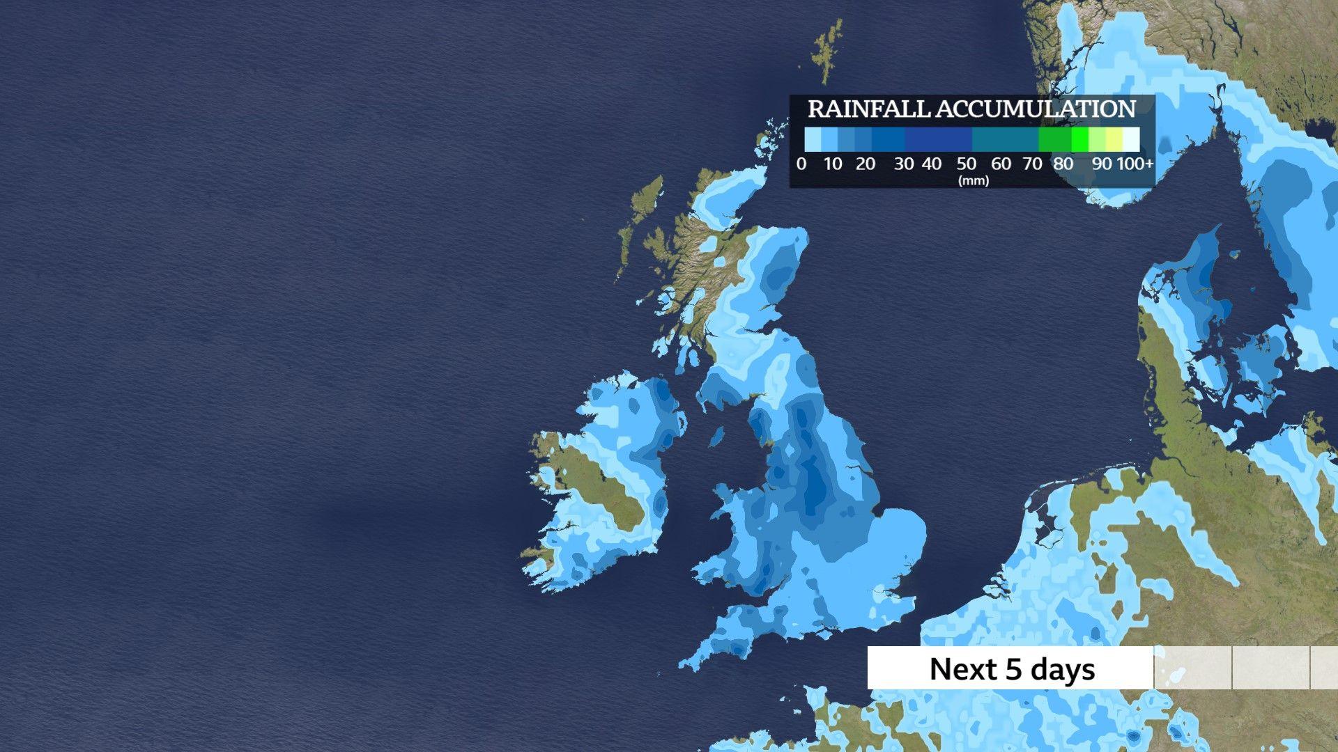
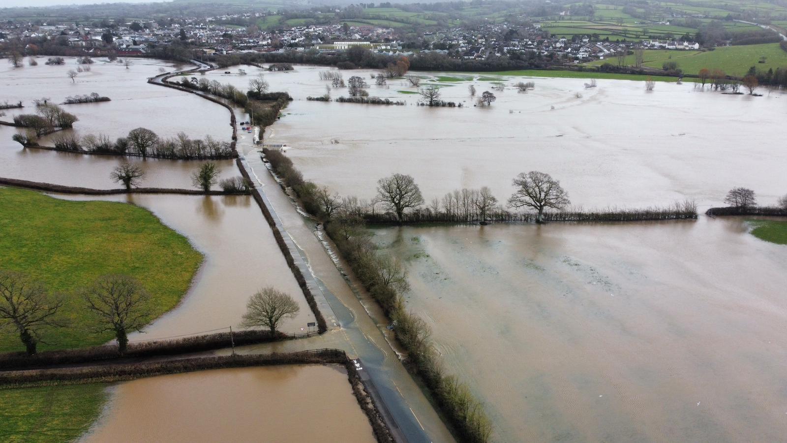
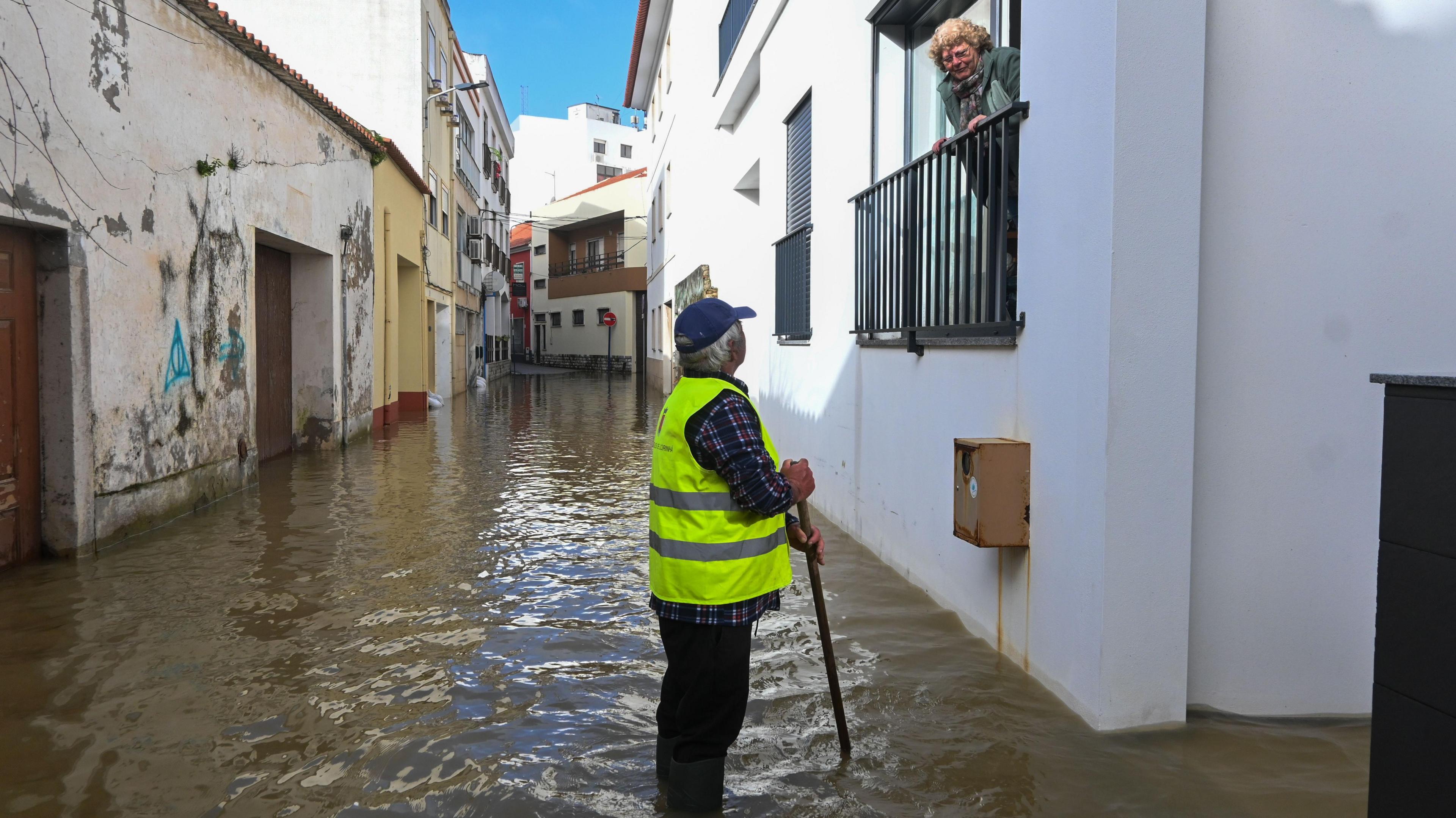
Numerous flood warnings are in effect across the UK after January ended with record-breaking rainfall and February has shown no sign of reprieve.
Persistent downpours have left the ground saturated in many areas and rivers bursting their banks.
As of Friday morning, more than 70 flood warnings had been issued across England and Scotland.
The Environment Agency has warned that river levels will continue to rise over the coming days as further rain is expected.
Met Office weather warnings in effect
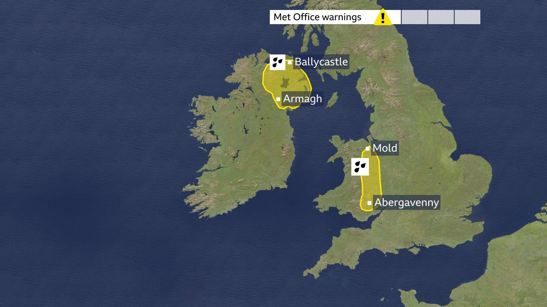
With rain forecast to continue, the Met Office has yellow weather warnings in place across the West Midlands and east Wales which run until 21:00 on Friday. Up to 20-30mm of rain is forecast with 50mm across higher ground.
Northern Ireland also has a warning in place for the remainder of the day, with 10-20mm expected in most places.
South facing hills could see up to 50mm and the Mourne Mountains and Antrim Hills may receive 60-80mm.
Strong winds will also add to difficult driving conditions.
Record rainfall
It has already been a record-breaking start to 2026 for some parts of the UK and February is continuing where January left off.
Unsettled weather fuelled by Storms Goretti, Ingrid and Chandra added to deluge for many.
Northern Ireland recorded its wettest January in 149 years. The country recorded 195.6mm of rain, 170% of its average for January.
For parts of south-west England and south Wales, it has rained for 36 days continuously days, every day of the year so far.
Meanwhile, Aboyne, Aberdeenshire, has already received more than its February average rainfall – less than one week into the month.
Unfortunately for many, the wet weather shows no sign of letting up in the short term.
The weekend looks more showery, though less windy and a little milder; however, there are signs pointing towards a colder, drier spell toward the end of the month.
 BBC Weather
-
Monthly Outlook
-
2 days ago
-
Contrasting rainfall across Scotland
There has been a notable difference in wetness across Scotland with Aultbea in the north-west Higlands not recording any rainfall since 18 January, instead enjoying some wintry sunshine.
This contrasts with the incessant rain we have seen in parts of eastern Scotland with Aberdeen seeing rain everyday for nearly three weeks.
This variation is also due to the wind direction, with rain being blown in by a prevailing wind coming off the North Sea, dragging in extra moisture which has enhanced both the rain and cloud.
Because of the south-easterly wind direction, places like Aultbea lie in the lee of the Cairngorm mountains, this is called the Fohn effect.
Not only has it been wet, but pretty dull too.
It’s been dull too, for Dyce in Aberdeen where the sun has not made an appearance for the last fortnight making it the longest overcast spell since 1957.
Disclaimer : This story is auto aggregated by a computer programme and has not been created or edited by DOWNTHENEWS. Publisher: BBC


