
One hundred areas of the UK face flooding as heavy downpours drench parts of the country, while the Met Office has issued yellow rain warnings for some areas.
As of 05:00 GMT on Tuesday, the Environment Agency had issued 98 flood warnings and 170 flood alerts in England, with saturated ground and already-swollen rivers making flooding more likely.
There are currently two flood warnings and four alerts in Scotland, and five flood alerts in Wales.
Overcast skies and rain have been a constant presence in the UK since the start of the year, and flooding is also an ongoing consequence of the very wet weather we’ve seen.
The cause of this very wet weather has been a weather pattern stuck in a “blocked” position for the last few weeks but there are signs of a very brief change before rain returns.
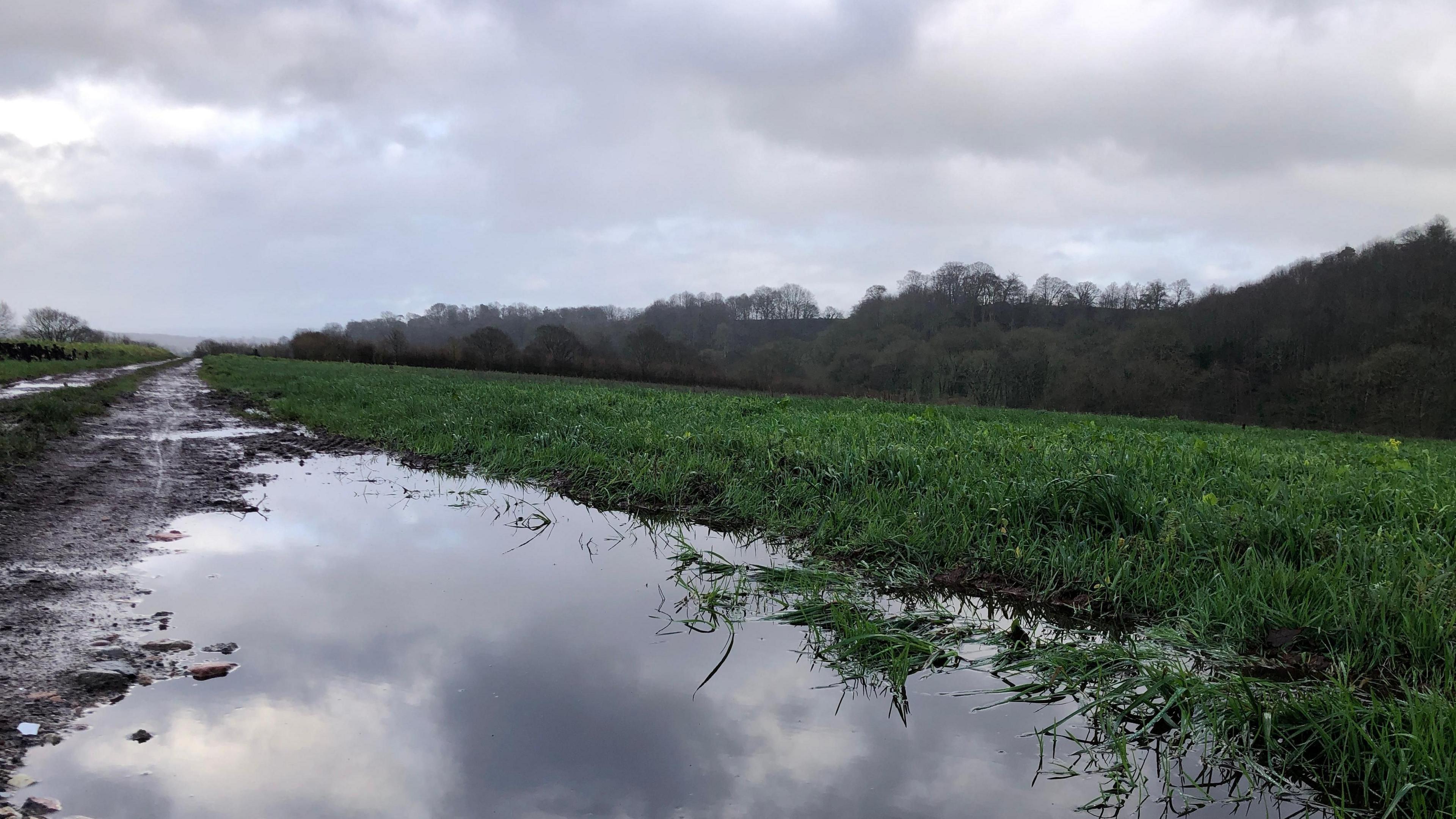 BBC Weather Watchers / Cath
On Tuesday rain will come in from the south-west of England and spread north-east across many parts of England and Wales.
Meanwhile rain will relentlessly continue across eastern Scotland with two yellow Met Office warnings in place from 09:00 GMT Tuesday to 23:59 on Wednesday with flooding and some transport disruption likely.
This region has been exceptionally wet so far this February.
According to data from the Met Office up to 8 February, Aberdeen has recorded 180% – nearly twice the average – of its monthly rainfall so far this year.
With 376mm of rainfall recorded, Aboyne in Aberdeenshire will soon surpass half its annual rainfall with more to come in the next few days.
Further south, Worcestershire and the Isle of Wight have experienced around their February average rainfall in just the first week of the month.
This additional rainfall comes after very wet weather throughout January.
South-west England, eastern Scotland and Northern Ireland were particularly wet with Cornwall and County Down recording their wettest January on record.
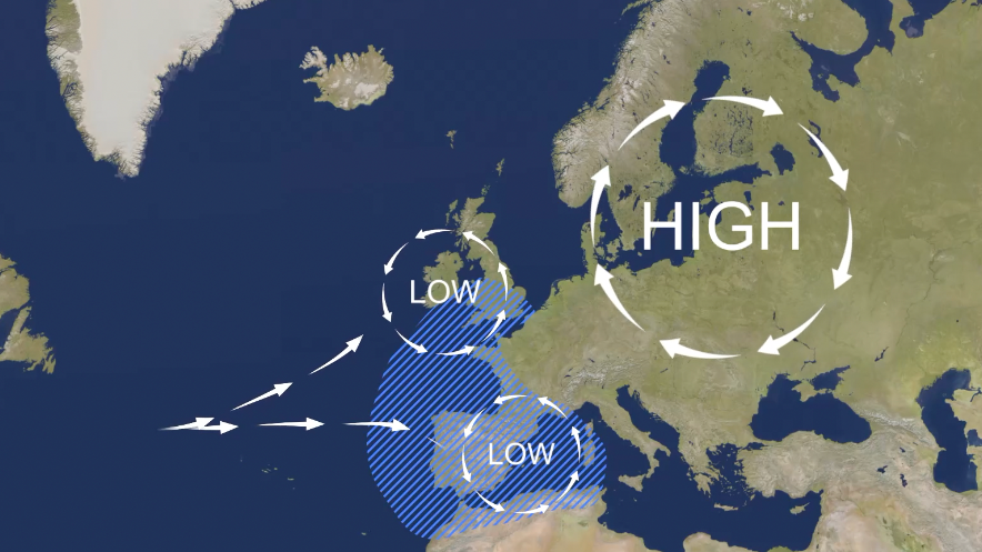 BBC Weather
Low-pressure weather systems have been stalling across the UK and Western Europe in general, leading to days of rain and cloudy skies.
It has been caused by a large area of high pressure being stuck across Scandinavia and acting like a road-block preventing weather systems from moving eastward as we’d normally see.
This is a “blocked” weather pattern and, while fairly common, it has been notable because of its consequences on the UK so far this year.
Blocked weather patterns can take on slightly different forms depending on where exactly large areas of high pressure can become stuck.
For example, if the blocked area of high pressure happens to be situated over the UK, it stops rain-bearing weather systems from arriving and gives us a prolonged dry spell.
In the summer, it can lead to droughts but also heatwaves as hot air is drawn in from the south-east.
Over the winter, it can make our weather dry, sunny and cold.
However, very small changes in position can make the difference.
If the blocking high was just to the north of the UK in winter, it allows very cold air from north-east Europe to arrive, resulting in similar conditions to the infamous “Beast from the East” in 2018.
How do we get blocked patterns?
Blocking patterns are caused mostly due to changes in the jet stream – the fast wind high in the atmosphere.
In a normal situation the jet stream would flow west to east across the Atlantic with weather systems being created by minor wiggles along it.
Occasionally the wiggles get bigger and that can result in big curves in the flow – like a meandering river.
High pressure gets trapped underneath these big curves and the jet stream gets weaker and disrupted.
The high pressure becomes stronger and gets stuck so the low pressure systems can’t push through and get diverted, resulting in the same type of weather for an area for days or weeks.
Blocked patterns will eventually break, caused by renewed energy in the jet stream or stronger low pressure systems being able to push through the high pressure.
When is the rain going to stop?
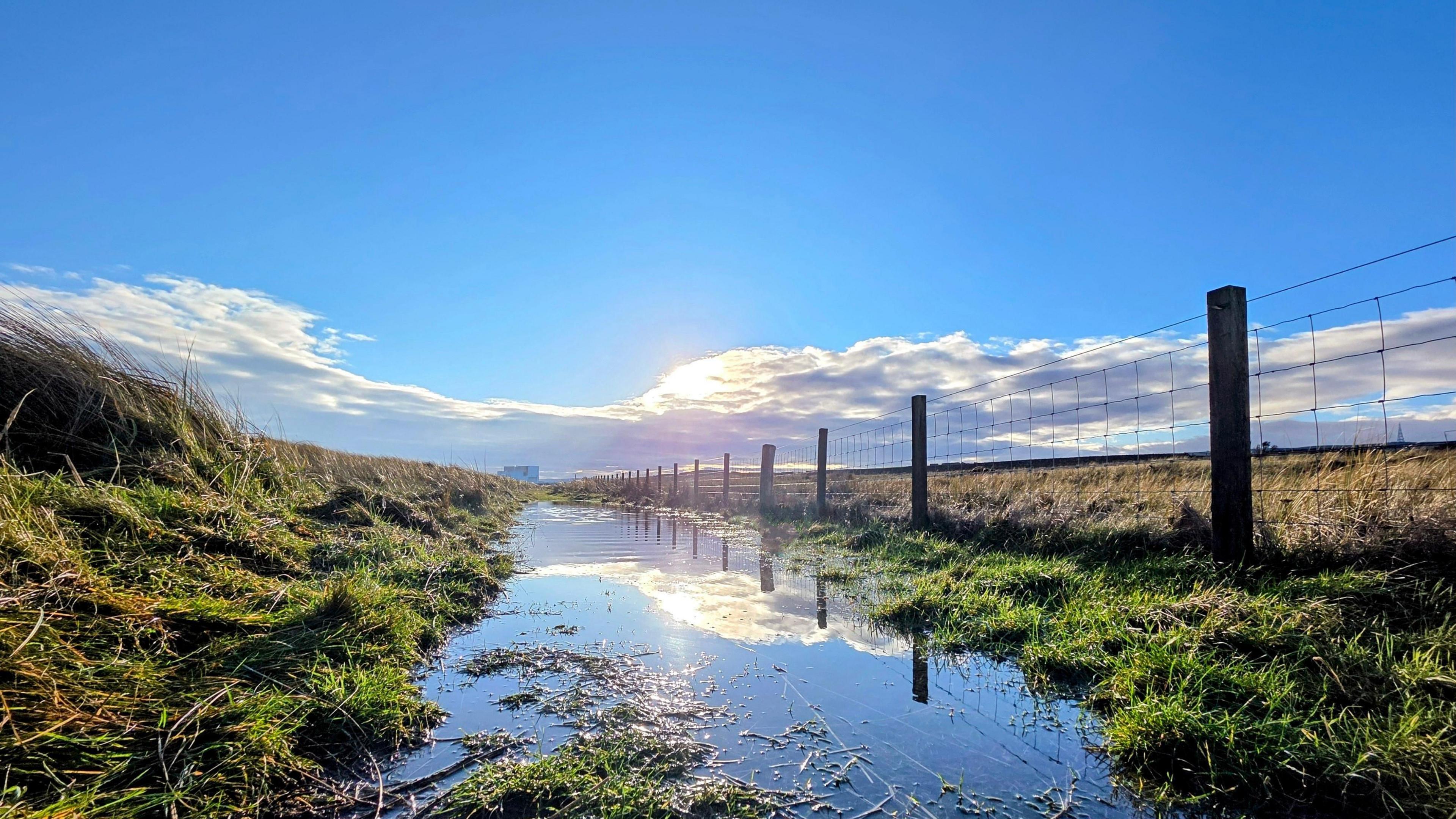 BBC Weather Watchers / Muddy Paws
This current blocked pattern does show some signs of breaking down by the end of this week.
Low pressure makes some progress eastward on Saturday which will lead to a northerly wind.
While this will bring lower temperatures and some wintry showers, for most it will be drier and sunnier compared with recent weeks.
However, this will be a very brief break. Rain will return on Sunday with a strengthening wind.
And as the rain hits the colder air from Saturday, there will be a temporary spell of snow even to low levels for a time across northern England and Scotland on Sunday morning.
The weather into next week then remains unsettled with further spells of rain and therefore the continued risk of some localised flooding. For the hour-by-hour forecast in your area keep checking the BBC Weather website and app.
You can get more detail on the long-range forecast in the monthly outlook.

Disclaimer : This story is auto aggregated by a computer programme and has not been created or edited by DOWNTHENEWS. Publisher: BBC


