 Getty
Getty-
8 December 2025, 10:12 GMT
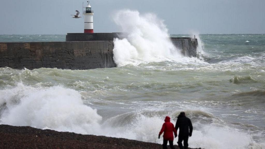
Severe weather warnings including an amber warning have been issued ahead of Storm Bram which is forecast to hit the United Kingdom on Tuesday and Wednesday.
Gusts of up to 90mph (144km/h) are likely across north-west Scotland but strong winds will be felt widely.
Heavy rain will also lead to localised flooding particularly in Wales and south-west England where ground conditions remain saturated from recent rainfall.
There is the possibility of damage and transport disruption.
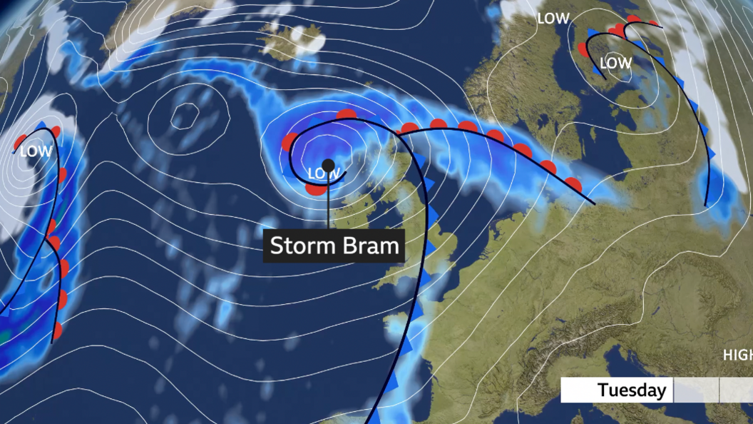
Storm Bram – named by Met Eireann, Ireland’s equivalent of the Met Office – develops rapidly on Tuesday, moving north to the west of the UK but bringing heavy rain and strengthening winds for all.
The strongest winds will be around Irish Sea coasts and up to the north-west of Scotland where severe gales are possible later on Tuesday.
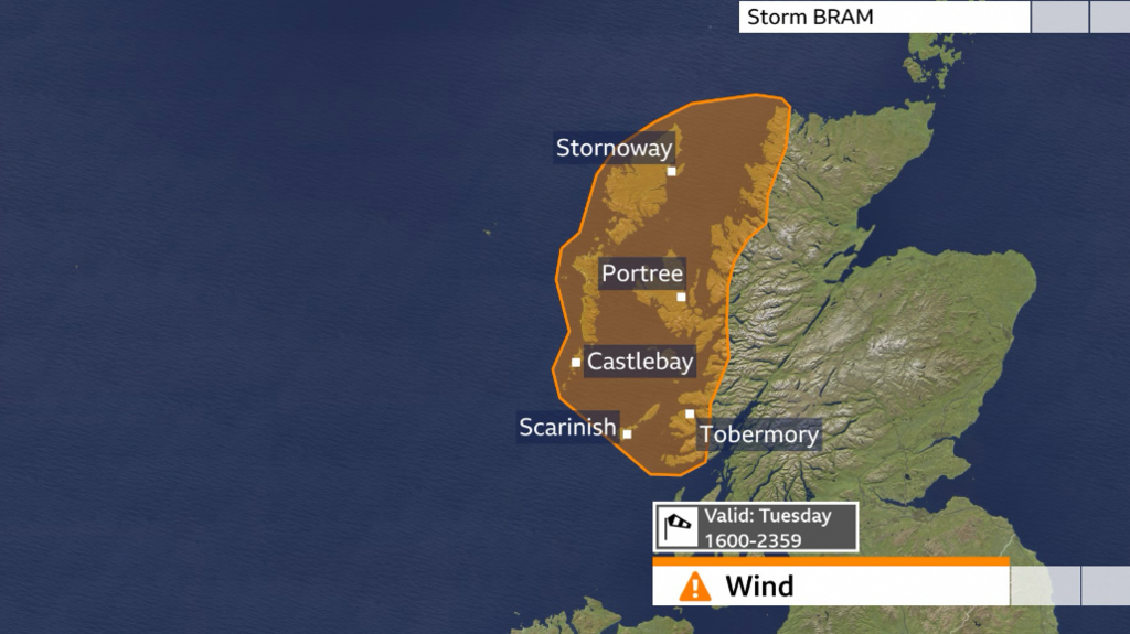
A Met Office amber warning for wind, valid from 16:00 to 23:59 BST Tuesday covers north-west Scotland where gusts of up to 90mph (144km/h) are possible for a few locations.
Impacts will include delays and cancellations to some of the transport network as well as damage to some buildings.
Yellow warnings have also been issued. The first comes into force across west Wales and south-west England from 22:00 Monday to 16:00 BST Tuesday with wind gusts widely 40-50mph (64-80km/h).
But additionally, yellow warnings will cover Northern Ireland from 09:00 to 21:00 GMT on Tuesday and much of Scotland and north-west England from 12:00 Tuesday to 06:00 GMT on Wednesday.
Gusts of 50-60mph (80-97km/h) will be felt widely but exposed coastal areas and higher ground could locally see gusts more than 70mph (113km/h).
Travel disruption and damage is also possible in these areas.
Flooding risk
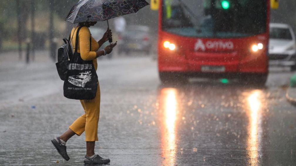
As well as strong winds, Bram will also bring some heavy rain into Tuesday.
In addition to the warnings for wind, there is a yellow Met Office warning for rain across much of Wales and south-west England from 18:00 Monday to 18:00 GMT Tuesday.
20-40mm (0.8-1.6in) of rain is expected widely with up to 80mm (3.2in) over Dartmoor and the higher ground of Wales.
The Met Office suggest there is a small chance of up to 100mm (3.9in) on the more exposed and prone hills.
After weeks of heavy rain at times, with the ground so saturated, there is the risk of further localised flooding.
More yellow weather warnings for rain cover north-west England from midnight to 15:00 GMT Tuesday and central Scotland from 06:00 to 12:00 on Tuesday where there could be a lot of rain falling over a short period of time.
Up to 80mm (3.2in) is expected over the Cumbrian hills in particular which could lead to some flooding.
The main area of rain will clear away to the north-east during Tuesday.
But, rain and strong winds are likely to continue especially across Scotland into Wednesday.
Over the last few months the UK has seen Storm Benjamin and Claudia which were named by France and Spain respectively.
So far we have only experienced one storm named by the UK Met Office and our storm naming group – Storm Amy. That is why we go back to the ‘B’ name – Bram – on the UK, Ireland and Netherlands storm naming list.
The next storm after Bram would be named Chandra if medium or high impacts are expected.

Disclaimer : This story is auto aggregated by a computer programme and has not been created or edited by DOWNTHENEWS. Publisher: BBC