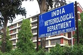
VISAKHAPATNAM: A low-pressure area is likely to form over the north Bay of Bengal and adjoining West Bengal-Bangladesh coast during the next 24 hours under the influence of an upper-air cyclonic circulation, according to the India Meteorological Department (IMD), Amaravati.
The IMD said the upper-air cyclonic circulation extends up to 7.6 km above mean sea level and tilts south-westwards with height. Lower tropospheric north-westerly winds continue to prevail over Andhra Pradesh and Yanam.
Private weather agencies and meteorological experts said the developing system is likely to strengthen the south-west monsoon and trigger widespread heavy to very heavy rainfall across eastern and central India over the coming days.
Senior scientist Dr S. Karunasagar said the impact of the system was likely to be felt in north coastal Andhra Pradesh about three days after the formation of the low-pressure area.
“North Andhra is likely to receive widespread rainfall, and temperatures are expected to come down,” he said.
Meanwhile, temperatures rose by 5 to 6°C in Bapatla, Ongole, Kavali, Nellore, Nandyal, Kurnool and Kadapa, with all these places recording maximum temperatures above 40°C on Tuesday.
Weather experts said the system is expected to revive monsoon activity after a prolonged lull. The weak monsoon phase had reduced rainfall across several regions, leading to rising temperatures, increased humidity and a slowdown in the sowing of major crops due to inadequate soil moisture.
They said the new system is expected to improve monsoon activity over the next few days, although the heaviest rainfall is likely to remain confined to eastern and central India.
Disclaimer : This story is auto aggregated by a computer programme and has not been created or edited by DOWNTHENEWS. Publisher: deccanchronicle.com