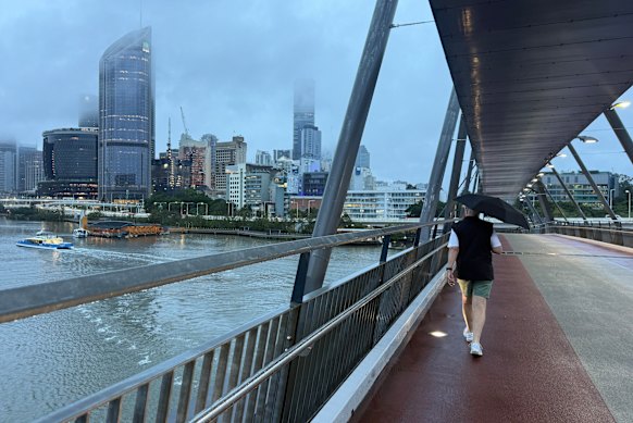

South-east Queensland residents have been warned to brace for more heavy rain, thunderstorms and possible flash flooding on Thursday after parts of the region were soaked overnight.
Suburbs north of Brisbane copped the heaviest rain throughout Wednesday, with Burpengary and Dayboro recording 69 millimetres and 61 millimetres respectively.
South and west of the city, Manly and Rosewood recorded 60 and 68 millimetres respectively, while Brisbane’s CBD reported a total of 45 millimetres.
Bureau of Meteorology senior meteorologist Jonathan How said high rain fell in a short period of time, heightening the risk of further flash flooding with more rain and thunderstorms predicted on Thursday.
“We did see big flash flooding in Burpengary yesterday,” How said.
“And then this morning, we are still seeing very heavy showers moving through the area.”
Heavy rain, large scale damaging winds and thunderstorms were predicted across south-east Queensland on Thursday, with the chance of flash flooding.
“A very active and unsettled day,” How said.
“And because of the rain we’ve had recently, everything’s quite soggy, so the rivers and creeks are ready to go and primed for flooding.”
Conditions are expected to ease by Friday, with only light showers predicted, ahead of sunshine and moderate temperatures of about 23 degrees over the weekend.
“It’ll all be done by tonight … and the weekend [is] looking really beautiful,” How said.
Over the 24 hours to Thursday morning, central and southern Queensland recorded 340,000 lightning strikes.
The highest rainfall total for the state was at a property north of Roma, with 89 millimetres.
Weatherzone meteorologist Ben Domensino said storms and heavy rain on Wednesday was brought on by an upper-level, low-pressure system passing slowly over south-east Queensland, destabilising the atmosphere.
“One reason this weather pattern is producing so much rain is because it is being fed by a steady feed of air from the tropics, which is also being boosted by additional moisture evaporating from the abnormally warm Tasman Sea,” he said.
“This setup is creating a conveyor belt of moisture, also known as an atmospheric river.”
Domensino said these weather systems were not uncommon in autumn and winter, but it was unusual to see them stick around for so long.
Start the day with a summary of the day’s most important and interesting stories, analysis and insights. Sign up for our Morning Edition newsletter.
From our partners
Disclaimer : This story is auto aggregated by a computer programme and has not been created or edited by DOWNTHENEWS. Publisher: www.smh.com.au