
The UK is likely to experience its hottest May day on record on Monday as searing heat continues.
Temperatures are forecast to reach as high as 34C, breaking the previous May record of 32.8C set more than 80 years ago. The 32.3C recorded at Kew Gardens in south-west London on Sunday was the highest of the year so far, the Met Office said.
It comes as eight regions in southern and eastern England officially entered heatwave conditions on Sunday, after three days at or above the temperature threshold.
Amber heat health alerts are in place in parts of the Midlands and eastern England until at least Wednesday.
Heat predicted to peak
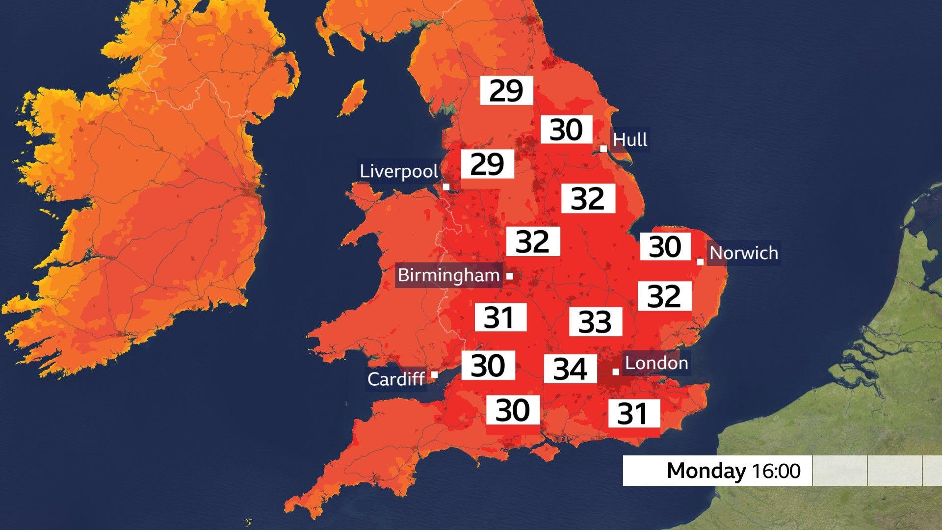
Monday and Tuesday are forecast to be the hottest days of the week with temperatures on both days reaching the mid-30s in southern Britain.
However, Monday will bring the most widespread heat with all nations set for their hottest weather so far this year.
Wales could also set a new May heat record in the next few days, surpassing the 30.6C recorded in Newport in 1944.
But it is not just daytime heat records at risk.
It is possible on Monday or Tuesday night that somewhere stays warmer than the May record of 18.9C set in Folkestone in 1947.
-
Hot weather: How to sleep in the heat
-
4 days ago
-
How long will the heatwave last?
The hot weather may spark a few thunderstorms in central England and Wales on Tuesday. However, they are likely to be very localised and not enough to cause a significant break from the heat.
On Wednesday, a break in the heat is expected widely across much of eastern and southeastern England. Cooler air will temporarily spread off the North Sea as some locations experience a five to 10-degree drop.
However, Wales and southwestern England will remain fairly hot, sheltered from the North Sea breeze. Highs, here, could still reach 30C.
By Thursday, the supply of cooler air will be cut off as hot air resurges from France once again. This means that temperatures will increase, with 30C back on the cards.
Most weather forecast models show that respite will begin next weekend and more starkly into next week.
The jet stream, to the north of us this week, will wobble back southwards, meaning areas of low pressure, occasional rain, stronger winds, and a drop in temperature as we head into the first week of June.
What is causing the hot weather?
The heatwave that began early last week across southwestern Europe is consistent with what we would expect in a changing, hotter climate.
Even by mid-summer standards, the current hot spell would be significant – let alone for May.
According to the latest European State of the Climate report, Europe is the fastest warming continent in the world with heatwaves becoming more frequent and more intense.
Since record-keeping began in the UK, there have only been a handful of years when temperatures reached or exceeded 30C in May.
Values in the mid-30s were once uncommon in the British Isles even at the height of summer, yet we are now on course to reach those levels before June has even begun.
Statistically, the UK experiences its highest temperatures at the end of July or the beginning of August, so it’s likely we’ll see even higher temperatures during the summer.
-
-
2 days ago

-

Disclaimer : This story is auto aggregated by a computer programme and has not been created or edited by DOWNTHENEWS. Publisher: BBC